


14 night Gataga Canoe Route
(approx. 300km)
Trip Overview
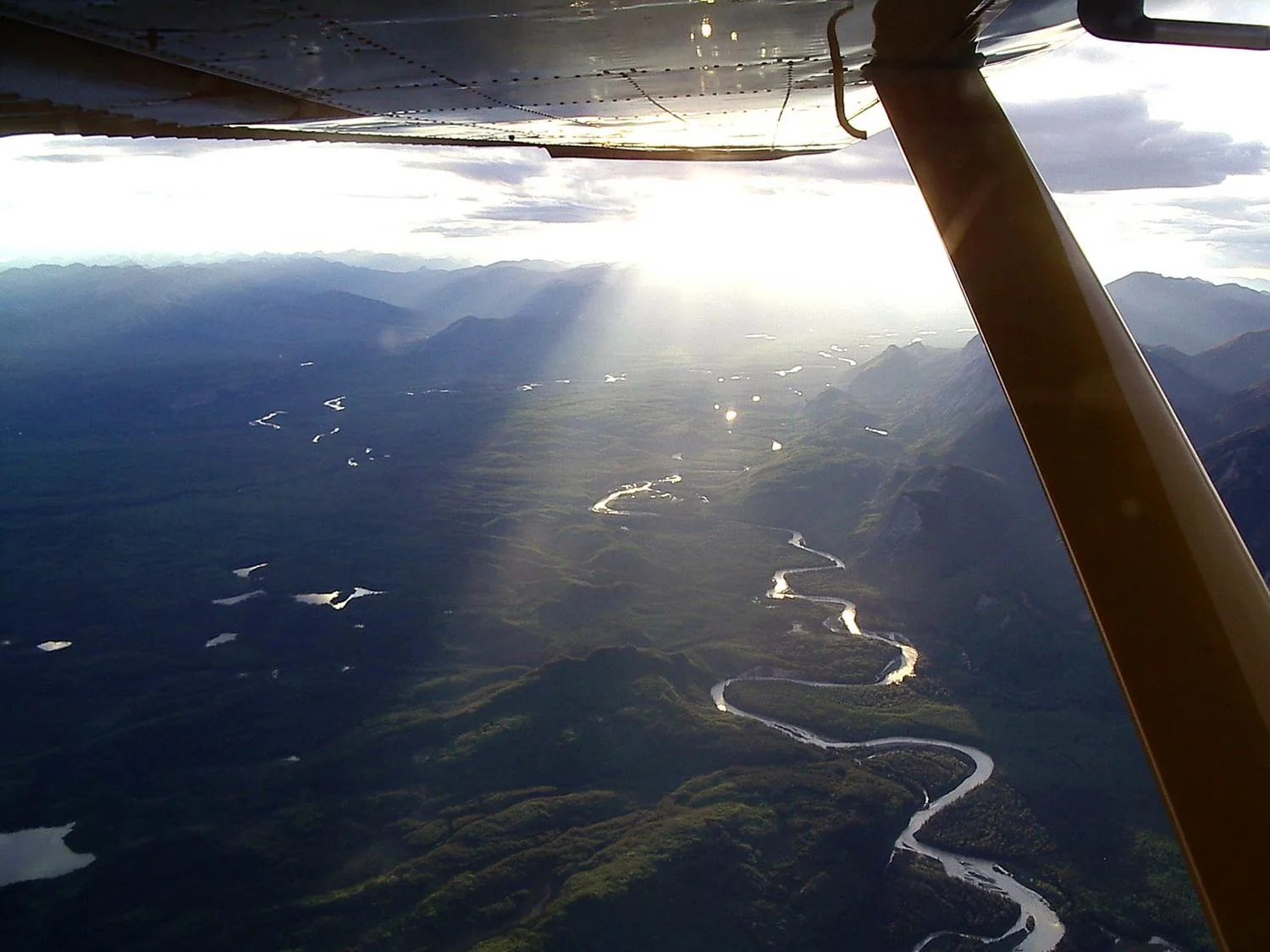
The Gataga/Kechika Rivers flow through the Rocky Mountain trench and join the Liard River near Fireside. This is a relaxing 14 night unguided package for every canoeist who would like to experience the serenity of the Northern Rockies and the Muskwa/Kechika Wilderness area.
We provide you with air transportation from the Northern Rockies Lodge on Muncho Lake - Mile 462 on the Alaska Hwy, flight to Gataga River (Mayfield Lake). Pick-up service at Fireside is available.
You start your trip approximately 25 miles downstream from South Gataga Lakes at Mayfield Lake and float out through a remote mountain valley over the Gataga and Kechika Rivers to Fireside on the Alaska Highway. There is excellent fishing on this trip.
Our many years of flying canoeists have shown us that this is a perfect tour for those with some river canoeing experience.
Detailed Trip Description
The South Gataga River has its headwaters in the northern peaks of the Rocky Mountains, running between the Rockies and the Kechika Range to the Kechika River. The Kechika flows north through the Rocky Mountain Trench into the Liard River. The river valleys consist mainly of white spruce, with some poplar and cottonwood groves along the shore. Not far above are the alpine meadows with a wide variety of flowers, shrubs and mosses.
Wildlife along the route includes moose, stone sheep in the Kechika Mountains, caribou, mule deer, some elk, goats, grizzly, black bear, wolf, beaver, lynx and other furbearers. Birds include Canada geese, harlequin ducks, loons, gulls, hawks, grouse, ptarmigan, jays, ravens, terns, and a few shorebirds. There are pike and grayling in the rivers and rainbow and lake trout in the lakes. Locals refer to the Kechika as the Muddy River, an indication of the silt that is carried downstream. Kechika is a Sikanni Indian word for "big windy," while Gataga means "white water," referring to the glacial silt washed down in the water.
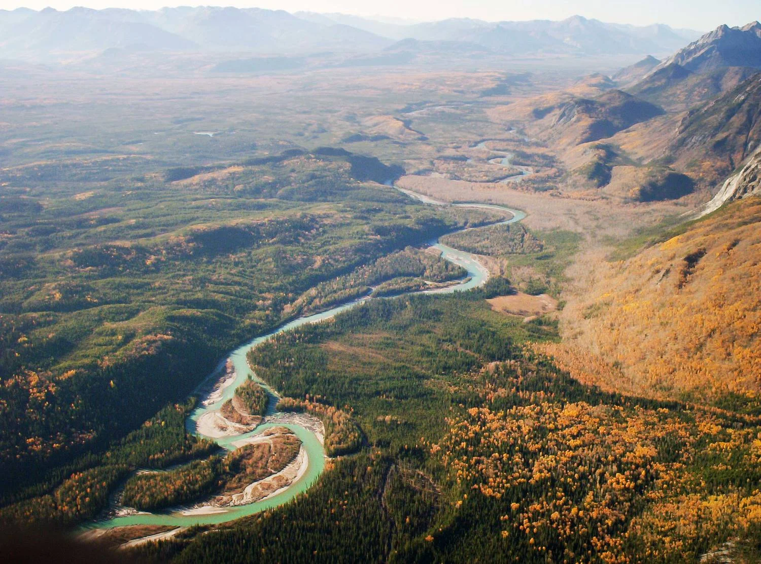
ROUTE ILLUSTRATE BETWEEN FLOATPLANE DROP OFF POINT AT MAYFIELD LAKE AND ENTRANCE AT GATAGA RIVER
Mayfield Lake near the confluence of the S. Gataga and the Gataga River is the start point of this river trip. A short 3 km portage trail leads from Mayfield Lakes down to the Gataga River (see image). Canoeists who are considering this excursion should scout the Gataga River for areas of probable portages. Located between Mayfield Lake and the Kechika River are at least 4 other rapids, that might be possible to canoe depending on the canoeing skills possessed by the people considering this trip. The first rapid is 1.5 km past Through Creek, about 50 km downstream. Here a large rock has formed two chutes best portaged by a 90 meter carry on the right, beginning on a sandy beach. The next rapid is a short distance downstream. From there to the Kechika watch for braided channels, possible logjams and deadheads. For the next 190 km of canoeing, watch for logjams, back eddies and boils. There are also some sharp turns. (Downstream 16 km from the Gataga Forks is Matulka Creek where a trail on the right leads to an Outfitting Camp.
Another 24 km downstream is an abandoned trading post. This used to be Skook Davidson's country, an individual who became a legend in his own lifetime as a horseman and guide. Fiftysix km downstream the Turnagain River flows in from the west. Downstream from this fork the Kechika stays in a single channel until the current begins to increase above the Liard River. Over these last 3040 km there are 8 sets of rapids. Some canoeists may prefer to portage some of these. At the Liard River canoeists will have to paddle across to Skook's Landing about 1 km downstream on the left bank of the Liard. It would be wise to paddle upstream a little first as the crossing allows no time for mistakes. The last rapid, just before the Kechika enters the Liard, is the most difficult of the river and canoeists need to determine in advance if portaging is necessary. Unconfident canoeists should portage or leave their canoe here. The Alaska Highway is just 360 meters away, and five kilometres north is Fireside, where limited services are available. This is a remote river, with many dangers of isolated travel. Canoeists are responsible for undertaking further research to ensure a safe trip.
Disclaimer: The information contained in this write-up was given by canoeists who have traveled the river. However above conditions can change as fast on the Gataga/Kechika, as on any other wilderness river. You are responsible to determine by yourself if you are able to canoe a wilderness river. We do not supply any maps. Please refer to the map information below for which maps to order.